
Hutto ZIP Code Coverage
Only one Hutto postal ZIP was confirmed in the official sources inspected: 78634. It covers the Hutto delivery area and addresses using Hutto, Texas as the postal city. The record does not mean every address carrying that postal label is inside the incorporated city. Edge and rural addresses can share the delivery area, while city limits, the ETJ, county addressing, appraisal parcels, and legal descriptions each use different boundaries. No second ZIP was verified for incorporated Hutto, so this table does not add one by guesswork.
| ZIP | Confirmed delivery area | Post office | Boundary note |
|---|---|---|---|
| 78634 | Hutto delivery area and addresses using Hutto as postal city | Hutto Post Office, 388 Exchange Boulevard | Can extend beyond incorporated limits; verify the individual address |
The Hutto ZIP code directory is therefore a postal verification tool, not a municipal roster. Use an address lookup and Hutto boundary material together when a record needs to be tied to a particular jurisdiction.
Hutto ZIP Code Post Office
The USPS Hutto Post Office listing gives 388 Exchange Boulevard, Hutto, TX 78634-9998, phone 512-759-2966. Listed retail hours are Monday through Friday 8–5 and Saturday 9–12. PO Box access is listed as 24 hours Monday through Saturday, with Sunday closed. The location lists PO boxes and general delivery among its services. Check the live USPS listing before a visit because service details can change.
USPS reported when the new Hutto facility opened in 2009 that it would serve 6,981 families and businesses in 78634 and increase PO boxes from 759 to 1,074. Those figures are a dated postal snapshot, not a present population count or a measure of people currently receiving mail in Hutto. They do show why old and current postal records should be dated carefully.
The official Hutto Post Office listing is the source for this Hutto postal-service reference.
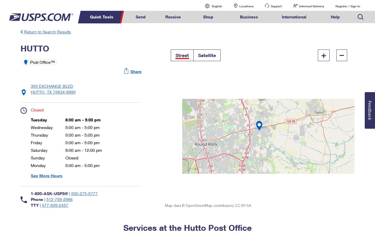
The postal listing helps confirm service location and a mailing label. It does not establish city incorporation, ownership, occupancy, or a person’s presence at any address.
Hutto ZIP Code USPS Fields
The USPS ZIP Lookup is the first check for a specific Hutto address. It has three separate modes. By Address standardizes a supplied address. By City and State returns postal locations for that combination. Cities by ZIP begins with the postal number. USPS also says a result standardizes an address but does not confirm that a person or company is there. Use the mode that matches the fact already known, then carry the standardized address into an official property or court record if needed.
| By Address | Company optional; Street Address required; Apt/Suite optional; City and State required; ZIP optional. |
|---|---|
| By City and State | City and State are required, then select Find. |
| Cities by ZIP | Enter the ZIP, then select Find. |
| Output | A standardized address and postal result, not confirmation of a resident or business. |
The official USPS lookup screen is the source for these Hutto ZIP code directory search fields.
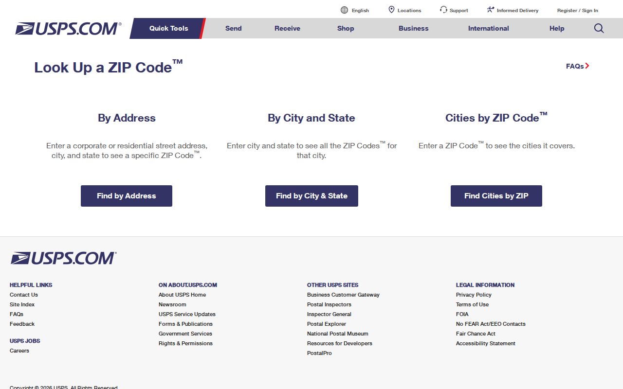
USPS says its ZIP database can change on a 30-to-60-day cycle. The AIS viewer provides current postal and ZIP+4 data for qualified use, is updated monthly, and is not presented as a public export tool or historic boundary archive.
Hutto ZIP Parcel Filters
For public parcel research, Williamson Central Appraisal District Advanced Search provides a City field and a Zip Code field. Those filters can be combined with a street, number range, neighborhood, owner, tax year, or legal-description input. WCAD is useful for narrowing a set of parcels in the Hutto delivery area. Its results concern public appraisal records, not a proof of who receives mail or lives at a property. The site also says its maps and data are supplied as is and may contain errors.
| WCAD field | Form type | How it narrows a Hutto search |
|---|---|---|
| Street Number Range | Two text fields | Limits results to a lower and upper number range. |
| Street Name | Text | Pairs a named street with a postal filter. |
| City | Text | Accepts Hutto or another postal or city value. |
| Zip Code | Text | Uses the verified postal filter. |
| Neighborhood | Text | Uses the WCAD neighborhood label. |
| Owner Name or Business Name | Text inputs | Offers an owner-side narrowing field. |
| Abstract/Subdivision, Block, Tract/Lot | Text inputs | Connects the search to the legal description. |
| Tax Year and Property Type | Dropdown and controls | Applies database and property-category filters. |
A parcel’s situs address is its physical location. Its owner mailing address may be elsewhere, and its legal description identifies the land in a deed. Keep those three fields separate when a Hutto search starts with a postal result.
Hutto ZIP Search Steps
A postal number can narrow a search, but it does not create a full list of Hutto residents. The best sequence uses the postal lookup for address verification, WCAD for public parcel filters, and the proper election channel only for the kind of voter information Texas makes available. Williamson GIS can locate a physical address, although the inspected text did not expose a ZIP-filter inventory. Hutto’s planning maps also did not expose a text search-field list.
- Check the street address in USPS By Address mode and save the standardized postal result.
- Use WCAD’s City and Zip Code fields with a street, number range, neighborhood, owner, or legal-description field as needed.
- Read the parcel as an appraisal record, keeping its situs, mailing, and legal-description fields distinct.
- Use Texas My Voter Portal for an individual lookup using the described name, county, date-of-birth, and ZIP inputs, not as a ZIP-wide roster.
- For a voter list or roster request, use Williamson County Elections’ request channel and follow the applicable public-record and confidentiality rules.
Once the postal area is narrowed to one street, the Hutto by-street directory has the address-level workflow. It is better suited to parcel and deed research than a broad ZIP filter.
Hutto ZIP Code Boundary Checks
Hutto’s city boundary map includes city limits, the county boundary, creeks, ETJ, development agreements, limited-purpose annexation, and major roads. That is why a Hutto mailing address can point to an incorporated address, an ETJ address, or unincorporated county territory. Williamson County Addressing maintains the countywide landline 911 master address database and updates its Valid Address Search about monthly. Contact the office for the most current certification when jurisdiction matters.
- ZIP and ZIP+4
- A ZIP identifies a postal delivery area; ZIP+4 adds a more precise delivery segment or destination range.
- PO Box ZIP
- A postal designation used for box service. No separate PO Box ZIP for incorporated Hutto was verified in the inspected sources.
- Unique ZIP
- A ZIP assigned to a single organization or institution. No Hutto unique ZIP was verified in the inspected sources.
- Carrier route
- A delivery-route grouping used by USPS. It is not a city-limit line, parcel boundary, or proof of occupancy.
Hutto ZIP Code Result Myth
A standardized Hutto result does not prove incorporation, occupancy, ownership, or that a person or company is at an address. USPS states that limitation directly. WCAD gives a different kind of evidence, an appraisal parcel, while county addressing resolves an official physical address and a deed uses a legal description. Each source answers a narrower question. The safe method is to label the source and date, then avoid drawing a conclusion the record does not support.
Hutto’s rapid growth also makes a single postal statistic unreliable as a current neighborhood count. The inspected school-district material associates 78634 overwhelmingly with Hutto ISD, but it is school-district geography, not a current postal population or municipal total.
Hutto Postal Geography History
Historic address work needs more than a present postal label. Hutto’s 1877 town plat, later 1884 and 1890s plats, railroad-era Front Street, Austin Avenue, East Street, Farley Street, FM 1660, and county-road descriptions can appear in older records. No official source verified a Hutto-wide renumbering or renaming project. Preserve the historic street wording, intersection, plat, survey or abstract, subdivision, block, and lot instead of inventing a conversion.
The 1921 Hutto Sanborn map can bridge an old place to a modern map search by showing streets and building footprints in that year. Pair it with a deed, plat, county address certification, and USPS result. Postal geography is one useful layer in that chain, but the recorded legal description is the durable land identifier when street names or delivery patterns change.
When a Hutto result conflicts, record four items side by side: the USPS standardized address, the WCAD parcel identifier, the County Addressing result, and the deed’s legal description. The county GIS search can locate a physical address, while the county’s Valid Address Search can provide an address-certification letter and is refreshed about monthly. The city boundary map is useful for distinguishing city limits, ETJ, county territory, and development areas, but it is not an ownership map. Compare the date of each source before deciding which office holds the next record. That preserves a clear trail when the postal city, city limit, and parcel description do not match.
For historical Hutto work, keep the original place language intact. A Front Street reference or an old lot number may need a plat and a deed before it can be related to a current delivery address. The research did not verify a citywide conversion table or a complete historic street-number record. An honest note about that gap is more useful than a confident but unsupported match.